A “sensitive receptor” includes any residence, school, healthcare facility, or any business or property open to the public. Among other things, SB 1137 bans the development of new oil and gas wells in the HPZ and requires operators to incur significant additional costs to continue production from preexisting wells. It also prohibits many maintenance practices necessary to continue production.
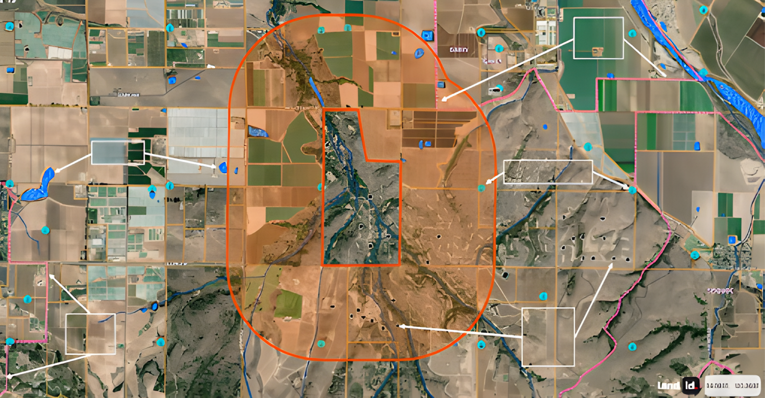
The 3,200-foot radius is a 6,400-foot diameter encompassing 738.5 acres. That is more than an entire section of land containing 640 acres. The previous standard setback for oil and gas wells was 300 feet, 600-foot diameter, which would encompass 2.1 acres.
All oil and gas mineral rights in California are impacted by SB 1137. It is now illegal to drill a well anywhere within the property line of all mineral rights that fall within the 3,200-foot setback. This includes “sensitive receptors” owned by the royalty owner. Your own house or other “sensitive receptor” on your own property takes your mineral and royalty rights. As an example, if a farmer puts up a fruit stand on their property, it will result in a taking of the surrounding 738.5 acres of mineral and royalty rights, even if owned by that farmer. This not only applies to existing sensitive receptors but also to all future sensitive receptors.
SB 1137 has no provision for notification to mineral and/or royalty owners that a sensitive receptor is being planned or built within the HPZ zone affecting the mineral and/or royalty owner’s property. In other words, a surface owner or tenant can build a sensitive receptor within 3,200 feet of someone’s mineral and/or royalty rights but, having done so, the impacted mineral and royalty owner’s rights will be severely diminished if not worthless. This makes it incumbent upon all mineral and royalty owners in California to be aware of any building permit applications, rezoning applications, and/or occupancy permit applications within 3,200 feet of their property lines.
At present, the only way for these owners to protect their interests is by opposing such permitting and development either through the permitting process, CEQA, and/or litigation. See below on how to obtain a satellite map of your mineral interest and the corresponding 3,200-foot setback. A sensitive receptor located within that setback triggers the process of diminishing the development of your oil and gas minerals.